This post is a re-creation of a page on an older web site.
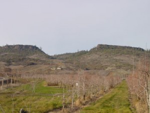
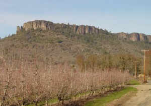
Two rock formations a few miles north of Medford comprise some of the most interesting geological and scenic views in Bear Creek Valley. The rocks are named for their relationship to the Rogue River just to the south of the formations, Upper Table Rock being upstream (to the east) of Lower Table Rock. Although there is some uncertainty about the exact date, a basalt lava flow about 9.6 million years ago flowed along an ancient meandering river canyon, depositing a 100-foot layer of basalt over the sandstone and gravel of the Bear Creek valley. This formation is officially known as the Payne Cliff formation. Erosion around the two table rocks left them standing approximately 800 feet above the valley floor, with Upper Rock officially at elevation 2,091′ and Lower Rock at 2,049′. Viewed from the air, the U-shape of Upper Rock shows the ancient meandering river canyon.
Upper Table Rock
The Upper Table Rock trail is approximately 1.25 miles in length, beginning about 150′ higher on the rock formation than the 1.75-mile trail on Lower Table Rock. There is evidence of further geologic uplifting movement between the two rocks. Upper Rock is tilted approximately 1 degree to the southeast, and Lower Rock is tilted 1 degree to the southwest.
Lower Table Rock
Native Takelma Indians who lived nearby called the environs “Titankah”–“Little Indian plums” and referred to the rock areas as “Di’tani”–“rock above.” Lower Rock had a airplane landing strip, which was closed in 1990 for liability reasons, and Upper Table Rock has a Very High Frequency Omni-Directional radio compass operated by the Federal Aviation Administration (not open to the public).
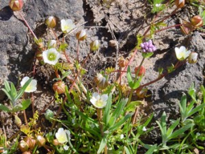
Dwarf wooly meadow-foam
Wildflowers bloom in abundance during the spring on the Table Rocks. Among the rarest is Limnanthes floccosa ssp.pumila, commonly known as Dwarf Wooly Meadow-foam. This five-petal white annual blooms for a 10-day period in March/April. The picture above was taken on Lower Table Rock on April 21, 2002. This flower is listed on the State of Oregon’s list of threatened plants because it grows only in vernal pool areas on the tops of the two Table Rocks and nowhere else in the world. It is considered to be very endangered.
In February 2009, I took a panoramic Gigapan picture of Lower Rock, which may be viewed at the following location:
http://gigapan.org/gigapans/17588


0 Responses
Stay in touch with the conversation, subscribe to the RSS feed for comments on this post.