Skip to content


Oakland Style BBQ Sauce

Some time back, I pledged to post my recipe for Oakland-style BBQ sauce.  With commentary, here is my recipe in a downloadable PDF file

Posted in Main, Personal.

Tagged with , .


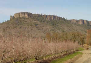
Table Rocks north of Medford

This post is  a re-creation of a page on an older web site.

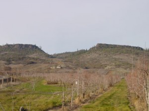
Two rock formations a few miles north of Medford comprise some of the most interesting geological and scenic views in Bear Creek Valley. The rocks are named for their relationship to the Rogue River just to the south of the formations, Upper Table Rock being upstream (to the east) of Lower Table Rock.  Although there is some uncertainty about the exact date, a basalt lava flow about 9.6 million years ago flowed along an ancient meandering river canyon, depositing a 100-foot layer of basalt over the sandstone and gravel of the Bear Creek valley. This formation is officially known as the Payne Cliff formation.  Erosion around the two table rocks left them standing approximately 800 feet above the valley floor, with Upper Rock officially at elevation 2,091′ and Lower Rock at 2,049′. Viewed from the air, the U-shape of Upper Rock shows the ancient meandering river canyon.

Upper Table Rock

Upper Table Rock

The Upper Table Rock trail is approximately 1.25 miles in length, beginning about 150′ higher on the rock formation than the 1.75-mile trail on Lower Table Rock.  There is evidence of further geologic uplifting movement between the two rocks. Upper Rock is tilted approximately 1 degree to the southeast, and Lower Rock is tilted 1 degree to the southwest.

Lower Table Rock

Native Takelma Indians who lived nearby called the environs “Titankah”–“Little Indian plums” and referred to the rock areas as “Di’tani”–“rock above.” Lower Rock had a airplane landing strip, which was closed in 1990 for liability reasons, and Upper Table Rock has a Very High Frequency Omni-Directional radio compass operated by the Federal Aviation Administration (not open to the public).

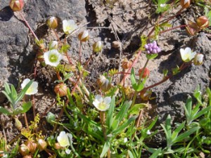
Dwarf wooly meadow foam

Dwarf wooly meadow-foam

Wildflowers bloom in abundance during the spring on the Table Rocks. Among the rarest is Limnanthes floccosa ssp.pumila, commonly known as Dwarf Wooly Meadow-foam.  This five-petal white annual blooms for a 10-day period in March/April. The picture above was taken on Lower Table Rock on April 21, 2002. This flower is listed on the State of Oregon’s list of threatened plants because it grows only in vernal pool areas on the tops of the two Table Rocks and nowhere else in the world. It is considered to be very endangered.

In February 2009, I took a panoramic Gigapan picture of Lower Rock, which may be viewed at the following location:

http://gigapan.org/gigapans/17588


Posted in Digital Photography, Interesting Places, Main.

Tagged with , , , .


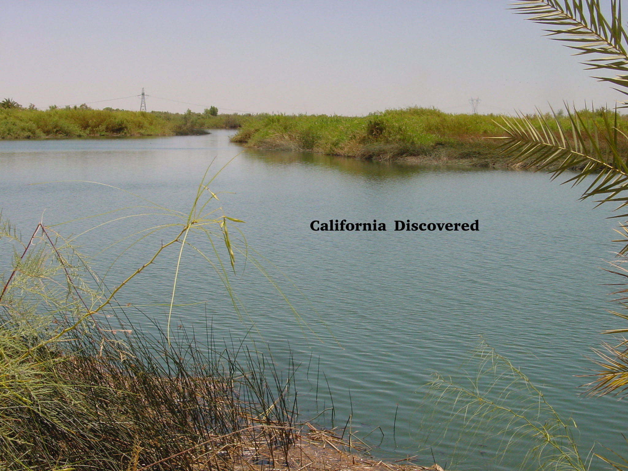
California Discovered

In the process of re-creating another post from my old web site–this one on an interesting point of view on the discovery of California by European explorers as opposed to the native population who were then present–I concluded the material was too long for a regular blog posting.

So, I turned the material into a downloadable document [filename: California Discovered.PDF]. The document is also available here. Feel free to share it with others, and you may re-post it as long as you credit me as the compiler.


Posted in Booknotes, Interesting Places, Main, Mapping.

Tagged with , .


Imperial County’s gold

As longtime friends  know, I spent almost nine years working in the Imperial Valley of California, having spent more than 15 years in the San Francisco Bay Area, and before moving to Oregon in 2000. I am in the process of converting some documents from my old web site (which, though it is no longer used still appears in Google indices). The following represents my first re-creation.

Agriculture has always been the driving force behind Imperial County’s development (indeed, irrigation of the arid Colorado desert by diversions from the Colorado River made possible its agricultural development). Yet the search for gold has also played an important part in its history.

Virtually everyone who has spent more than a few months in California knows about John Marshall’s discovery of gold near Coloma, and the great California gold rush of 1849 and thereafter. It was not the Marshall’s finding of gold, but the publicity given to it, that led to the belief that Marshall had “discovered” gold in California.

In fact, Erwin Gudde’s California Gold Camps documents the discovery of gold in California in the San Fernando Valley in 1842, six years before Marshall’s discovery. Francisco Lopez was credited with the discovery of gold at March 9, 1842 in Placerita Canyon east of Newhall, Los Angeles Co., California. The first recorded evidence that gold was mined in this area was the sale of 20 ounces of gold recorded at the Philadelphia mint by Abel Stearns on November 22, 1842, according to Gudde (see p. 306). According to his research in the gold camps and other sites of California, Gudde found that earlier reports of gold mining in the San Fernando placers could not be verified.

In Gudde’s discussion of mining activity in the Cargo Muchacho Mountains in southeastern Imperial County, he cites a Report of the State Mineralogist, Vol. IV, that gold was allegedly found in Imperial County in 1775. Gudde commented (p. 412), however, that these early publications of the California Division of Mines are “not entirely dependable on historical facts.” So unless additional historical materials are discovered that would verify accounts of pre-1840 gold mining, any claim that Imperial County was the site of the first discovery of gold remains unverifiable. Nevertheless, we can quickly see that gold was found all over the county.

Cargo Muchacho Mountains

This district is located approximately 12 miles west of the Colorado River near the Ogilby Station of the Southern Pacific Railroad. Rich in gold, it could not be exploited by placer mining because of the lack of water. According to the California Division of Mines, this area was the site of the first gold discovery in California in 1775, but this cannot yet be verified.

Lode mining developed in the district in the 1870s, and in 1882 the Yuma Mining Co. crushed $167,000 work of gold from 14,000 tons of quartz at its stamp mill. At Hedges, a large mill of 140 stamps. When the Post Office was established in 1910, the town was renamed to Tumco from the United States Mining Co. In 1938, a rich pocket of gold at the American Girl Mine to the north and the Golden Cross Mine produced $4 million in gold. The best account of mining in the area up to 1942 is contained in the Report of the State Mineralogist, Vol. XXXVIII, p. 112, according to Gudde. The Tumco/Hedges web site by Desert USA shows photographs and a map to the area.

Mesquite Placers

Large scale mining operations have been carried out in the since 1878 in the Chocolate Mountains. Along the southern spur, there is an area called Mesquite placers. Located in this area is the Mesquite Gold Mine, just off Highway 78 northeast of Glamis. Before 1900, water was brought to the area from Glamis to wash the gravels, and in the 1930s, there were unsuccessful attempts at dry placering in the area. The area will soon seen a change in use from gold mining operations, which ceased recently, as the site is being converted to a regional landfill.

Ogilby Station

Ogilby Station was located on the Southern Pacific Railroad. From 1890 to 1942, it served as the post office for the American Girl and other profitable mines in the Cargo Muchacho Mountains.

[mapsmarker marker=”2″]

Picacho

Picacho is located near the bend of the Colorado River north of Yuma, and named after the nearby Picacho Peak, a obelisk-shaped mountain rising 1,947 feet above the desert floor. Gold deposits were discovered in this area in 1857, and Mexican miners using dry placering attempted to extract the precious metal. The most productive period was at the Picacho Basin Quartz Mine about five miles south of the village, where from 1904-1910 approximately 30 claims produced about $2 million on gold. The area may be reached by Picacho Road north of Winterhaven, or on Hyduke Mine Road east from Ogilby Road.

Pothole Placers

There have been persistent stories of mining in this area northeast of Yuma in the 18th Century, but these are not supported by convincing evidence, according to Gudde (see p. 274). Gold production in this area totaled $2 million between 1850 and 1934, when dry washing was still going on.

Even today, modern-day miners and others seek to explore Imperial County’s bountiful lands.

Sources:

California Division of Mines, Report of the State Mineralogist (Sacramento), Vol. IV, p. 217.

California Division of Mines, Report of the State Mineralogist (Sacramento), Vol. XIII, p. 339.

California Division of Mines, Report of the State Minerologist (Sacramento), Vol. XXXVIII, p. 112.

California Division of Mines, Bulletin 193, Gold Districts in California, prepared by William B. Clark (Sacramento: 1970).

Gudde, Erwin G., ed. by Elisabeth K. Gudde. California Gold Camps (Berkeley: University of California Press, 1975).
 

Posted in Booknotes, Interesting Places, Main.

Tagged with , , , .


Trying out a new plugin – Leaflet Maps Marker

I’m experimenting with a new WordPress plugin, allowing you to insert maps in posts. I think it will be very useful when describing family history places, favorite photos and other locations of interest.

[mapsmarker marker=”1″]

Posted in Computer Interests, Main, Mapping, Web Site News.


Best Wishes for a Healthy and Happy New Year

Manuela and I would like to wish all our family members and friends all the best for 2012.  For those with health issues, we will be thinking of you, and for those who are enjoying life without health issues, please keep a smile on your face and cheer up someone around who may be less fortunate.  Hug your kids if you can, and shower your grandchildren with all the knowledge you have gained through your life experiences. Don’t worry if they don’t believe you now. Some of it is bound to stick.

Posted in Main.


Family Tree Database Updated

It has been several months since I published a major update to my family tree data base via this site. Since I updated to Family Tree Maker 2012, with its tree synchronization feature on Ancestry.com, it occurred to me that a similar update was necessary to my data at https://www.detling.us/TNG. My data is also available on World Connect at rootsweb.com (family filename: Detling).


Posted in Bradt/Brott Family, Bunker Family History, Detling Family History, Main, Roblee Researchers, Web Site News.

Tagged with , , , , , , .


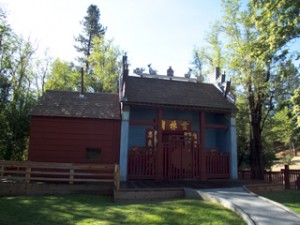
Visit Weaverville’s Joss House while you can


Saturday–lacking another alternative to sitting in a hotel room all day waiting for my 45th high school reunion dinner–Manuela and I drove from Redding to Weaverville (about 42 miles on the way to the coast on Highway 299), home of the oldest continuously used Chinese temple in California…the Weaverville Joss House. We arrived shortly before the historic temple exhibit opened at 10 a.m. (the temple is open only Thursdays and Saturdays, and then only through June 30, 2012, when the historic wooden structure is likely to be permanently closed due to California Department of Parks and Recreation funding cuts).

The historic temple is the third version of the Taoist house of worship (the first two were destroyed by fires in 1861 and 1873), leaving it up to the Chinese community in Weaverville to rebuild and maintain it, a task that become much more difficult after the Chinese population dwindled to 16 residents in 1931.  Moon Lim Lee became trustee in 1938, and worked tirelessly for nearly 20 years to preserve this structure as a statewide treasure for all Californians–not just those of Chinese descent. The Joss House became part of the California Park System in 1956. While the structure will still stand, the internal furnishings will be boxed and moved to storage in Sacramento after the park closes in 2012.

The term “joss” is believed to be a corruption of the Portuguese word for “Deus,” meaning God. Thus a temple where Chinese gods are worshipped is called a “joss house.” A small Taoist joss house was first built in Weaverville about 1853, and called the Won Lim Miao (Won Lim Temple). Both the first two temples were located downhill from the present temple building, and were must more susceptible to fires than the current structure. The temple is reached by crossing over a bridge (which changes elevation) and a sharp curved pathway (both symbolic of the way to peace because evil spirits only travel in straight lines and unable to travel over barriers such as steps or around corners).

Three Chinese characters appear above the main entrance to the temple, reading from right to left Temple-Forest-Cloud, or “The Temple of the Forest Beneath the Clouds.”

There are steps before the temple door, and an internal door permanently locked so that one must go around the door to reach the temple proper, respecting the cultural symbolism of blocking evil from the temple.

The Weaverville Joss House also contains a three-room schoolroom, kitchen and relatively primitive sleeping area. The Chinese recruited a teacher for the school as a caretaker by advertising in Sacramento with a reference to the high quality accommodations.

When the Joss House is closed, a part of history of more than a century in California will be lost. Whether it can or will be saved cannot be answered just yet. As my good friend and professor Royce Delmatier once wrote, California’s history can be charted only from its stern, for it can only see where it has been and not where it is going. Weaverville’s Joss House is just one more example of this sad state of affairs.

See photos at: http://greencity.phanfare.com/5283931

Posted in Community Musings, Main, Personal.

Tagged with , , , , .


Get the versatility of a tablet in an e-reader – updated

A couple of weeks ago, I saw a notice on a site devoted to the Android operating system (used in many smart phones and tablets) regarding a miniature memory card that would convert a Barnes and Noble Color Nook into a tablet with many Android applications. The microSD card with the Android system, including some apps, cost the price of the SanDisk card itself.  I had been disappointed with the add-on applications that came with the Color Nook but love its e-book reader features.  So I was intrigued by the prospect of getting my e-mail, keeping my contacts and calendar, accessing PayPal and my bank accounts, and a host of other applications such as Google Earth and Google Maps–just like I can on my HTC 4G smartphone with its 4.3 inch screen–only this time on a 7 inch reader. Granted, it’s not an iPad or a 10 inch Android tablet. But a 8 1/2 by 11 document in PDF format can be resized and read quite easily on the modified Color Nook. And the installation and rebooting process was a snap.  Now, I can have an Android tablet instantly on, or reboot to the original Nook OS without voiding any warranty or affecting the built-in operations of the book reader.

There is a Nook reader application included, but it took me a while to figure out how to access my previously purchased books. There is also an Amazon Kindle application pre-installed on the microSD card, which also permits access to Amazon purchased ebooks.

I also installed a music application called Audiogalaxy that permits me to play music from my PC at home on my tablet (the same application is also installed on my cell phone). I have access via phone or tablet to thousands of songs in my music library.  Since these files are stored locally on my PC in lossless format (FLAC) and only the directory of files is stored “in the cloud” I don’t have to use precious memory on the phone or tablet for music.

I definitely am happy with this purchase, and I can’t wait to download an agenda packet for the HRA VEBA trust board meeting in October to see how it functions in real-time when attending a daylong meeting.  If it works as well as it seems, I may never decide I have to have an iPad or Android tablet.   Of course, if the price-performance equation is right, I could be tempted by an Amazon tablet (due out later this year) or an Archos G9 with its internal storage capabilities (tentatively scheduled for September).

Posted in Computer Interests, Main, Music.

Tagged with , , , .


Down the Colorado River through the Grand Canyon

I just finished a paperback (not an e-book) entitled Down the Great Unknown, by Edward Dolnick, a historical treatment of the Powell expedition’s 1869 journey down the Green and Colorado Rivers through the Grand Canyon. It is a carefully researched history of the journey (organized by John Wesley Powell) that is a more complete picture of this incredible feat. A successful expedition, in Dolnick’s view, was anything but foreordained. “Powell’s 1869 expedition launched his career, but it came within a boat length or two of drowning him before he had become even a footnote.” This is a first rate account, easily read, and thoroughly documented.  It also contains interesting speculation of the fate of three of the four adventurers who left the party before the journey was completed (I won’t divulge details of this part of the story).

Dolnick, Edward. Down the Great Unknown. (New York: Harper Perennial, 2001).


Posted in Booknotes, Main.

Tagged with , , , .